NRAR uses satellites to watch for illegal floodplain harvesting
The Natural Resources Access Regulator (NRAR) will use state-of-the-art satellite technology to see if water users are complying with the state’s floodplain harvesting laws.
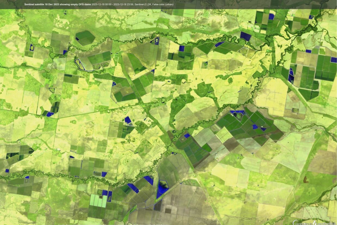
NRAR’s spatial analysts will check Sentinel satellite imagery of on-farm storages over time to see when dams are being filled from water moving across the floodplain. This will be compared with rainfall data for the location and specific water licence conditions to determine if any rules have been broken.
With the Bureau of Meteorology forecasting possible significant falls of rain in the north of the state this weekend and into next week, water users in the Border Rivers and Gwydir Valley water-sharing areas are reminded they can’t harvest floodwater without a licence and compliant metering equipment.
Water users wanting to capture any water moving across a floodplain can only do so if they have primary metering equipment installed by a qualified installer.
NRAR Director of Education and Engagement, Keeley Reynolds said the NSW Government’s reforms to control floodplain harvesting within legal limits became law in the Border Rivers and Gwydir valleys in 2022.
"Having a licence means people have the right to capture and store water as it flows across the floodplain, but it also means they have to measure and report their water take in accordance with the conditions of their linked water supply works approvals,” Ms Reynolds said.
“That means installing compliant metering equipment," she said.
"Licence holders in these areas have had more than a year to comply with the new rules, and we do expect water users to have done so by their deadline.”
Ms Reynolds said the independent regulator understands there may be some barriers, such as availability of qualified installers and difficulties getting equipment.
"However, if people choose to capture water from a floodplain without a licence or without compliant metering equipment, they may be subject to enforcement action by NRAR regardless of those barriers,” she said.
“We remain steadfast in our commitment to ensure all water taken in NSW is done in accordance with the rules for the benefit of all communities and the environment.
“The time to act is now so that when and if further rain does fall during the autumn and winter, water users are compliant and can lawfully capture water from the floodplain according to their licence and approval conditions.”
Ms Reynolds said accurate measurement underpins effective and efficient management of the state’s water resources. The best way to achieve that level of accuracy is through installing telemetered metering equipment.
Read more about what is happening in other river valleys