Water users can’t harvest from floodplain during wet period unless they have compliant meters
Water users in the Border Rivers and Gwydir Valley water sharing areas are reminded they can’t harvest floodwater from current rain events without a licence and compliant metering equipment.
The Natural Resources Access Regulator (NRAR) said the Bureau of Meteorology is predicting a high chance of showers and storms in northern NSW right up to Christmas Day. Cumulative falls are possible from 20 December to 27 December of 50-100mm in a widespread region across the northern Murray Darling Basin.
Water users wanting to capture any water moving across a floodplain can only do so if they have primary metering equipment installed by a qualified installer.
NRAR Director Education and Engagement Keeley Reynolds said the NSW Government’s reforms to control floodplain harvesting within legal limits became law in the Border Rivers and Gwydir valleys last year.
"Having a licence means people have the right to capture and store water as it flows across the floodplain, but it also means they have to measure and report their water take in accordance with the conditions of their linked water supply works approvals,” Ms Reynolds said.
“That means installing compliant metering equipment," she said.
"Licence holders in these areas have had more than a year to comply with the new rules, and we do expect water users to have done so by their deadline.”
Ms Reynolds said the independent regulator understands there may be some barriers, such as availability of qualified installers and difficulties getting equipment.
"However, if people choose to capture water from a floodplain without a licence or without compliant metering equipment, they may be subject to enforcement action by NRAR regardless of those barriers,” she said.
“We remain steadfast in our commitment to ensure all water taken in NSW is done in accordance with the rules for the benefit of all communities and the environment.
“The time to act is now so that when and if further rain does fall during the summer, water users are compliant and can lawfully capture water from the floodplain according to their licence and approval conditions.”
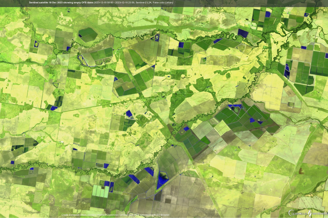
NRAR continues to use the latest technology to understand conditions on the ground and how they relate to compliance. The latest cloud-free Sentinel satellite imagery from 18 December (pictured) shows numerous empty and partly filled on-farm storage dams across the Northern Murray Darling Basin.
Comparing this type of imagery over time allows NRAR to know when dams are being filled from storm runoff and to check this against water licence entitlements and conditions.
Ms Reynolds said accurate measurement underpins effective and efficient management of the state’s water resources. The best way to achieve that level of accuracy is through installing telemetered metering equipment.
Read more about what is happening in other river valleys